Vision
“An economically leading dzongkhag with cohesive society, vibrant culture, sound environment and balanced development.”
Mission
Provide conducive environment for diversified economic activities and for the wellbeing of people in the dzongkhag.

Chhukha Dzongkhag is the point of entry into western and central Bhutan from India. Its Drungkhag (sub-divisional district) is located in Phuentshogling, which is one of the busiest commercial hubs. Phuentshogling, a major town, is the entry point for imports as well as the exit point for exports. The dzongkhag was established in April 1987 with a population of about 84,203. The dzongkhag spans over an area of about 1882.38 square kilometers and is located at an elevation ranging from 160 to 4480 meters above sea level. Chhukha is connected to the capital city, Thimphu, with a double-lane motor road, and local transport buses ply every hour.
Farm roads have reached all the gewogs, and the same applies to other facilities like drinking water, electricity, and mobile networks. All the gewog offices have been connected to GovNet since 2016 by DITT, MoIC. The network was extended to other government offices like BHUs and schools in the fiscal year 2017-2018 by the ICT office, Chhukha Dzongkhag. The dzongkhag has the Chhukha Hydro Power Plant and the Tala Hydro Power Plant, which are key sources of national income. Pasakha is an industrial township.
The majority of the people depend on livestock and subsistence agricultural farming. Paddy is the most commonly cultivated food crop. Mandarin, potato, and cardamom are the main cash crops in the dzongkhag. Chhukha has one thromde, one drungkhag, and 11 gewogs.
Dzongkhag Profile:
Geographical area: 1882.38 square kilometers
Population: 70,371 (2017 projected)
Male: 36,124
Female: 34,246
Households: 2,870
Drungkhag: Phuentshogling Drungkhag
Gewogs: Bjagchhog, Chapchha, Bongo, Darla, Doongna, Getena, Geling, Loggchina, Maedtabkha, Phuentshogling, and Samphelling
Contact us
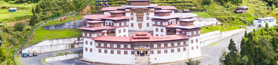
- Ngoedrup-Tse Dzong, Tsimasham, Chhukha, Bhutan
- P.O Box No. 01
- Toll Free 1533
- Fax No. +975 (08) 478213